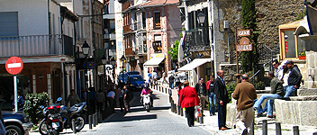
")

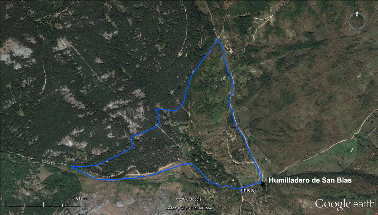
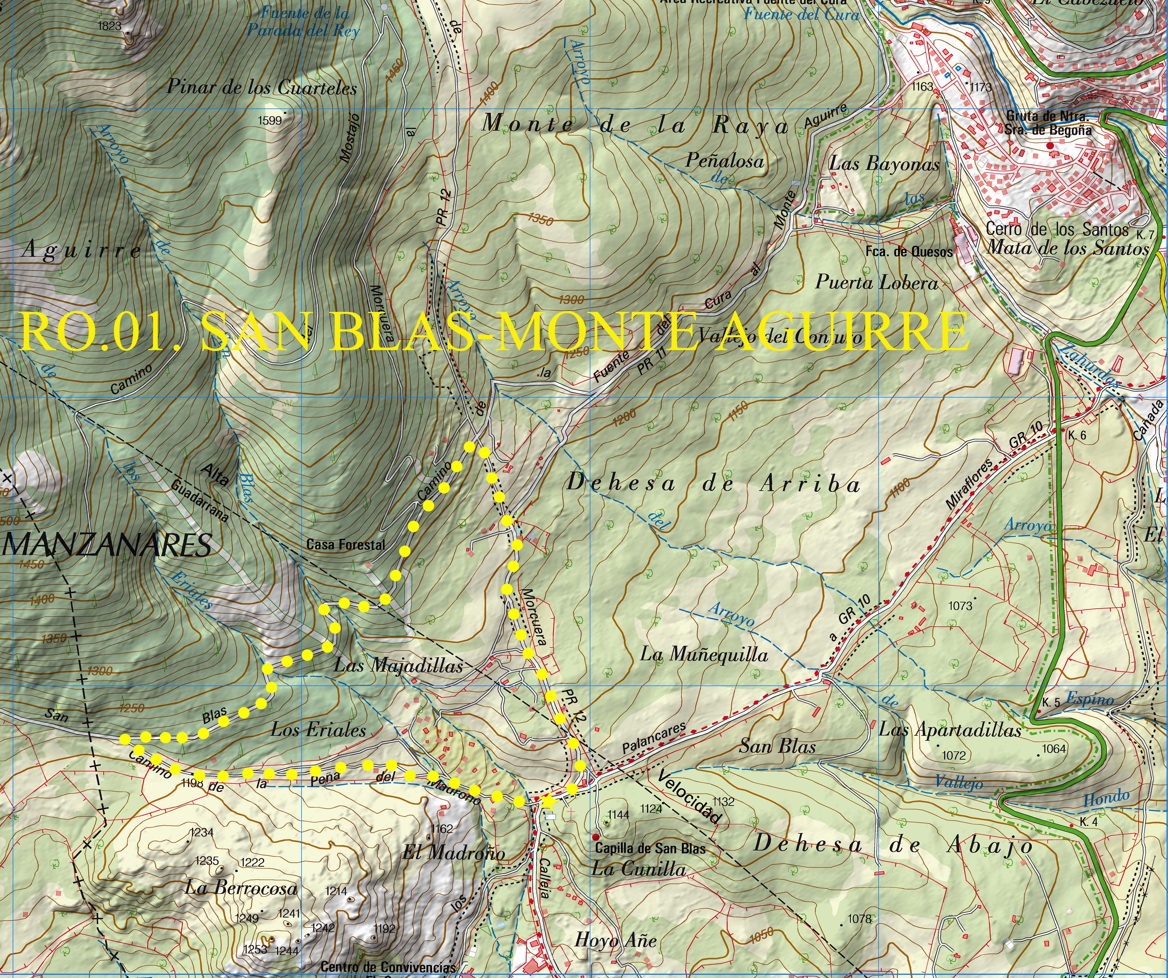
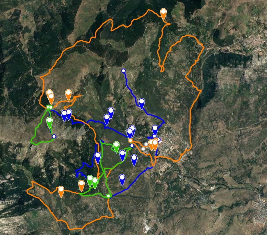
San Blas – Pinar de Aguirre - San Blas
Distance: 6 km (circular).
Time: 2 h. Estimated time allowing for pauses to observe the fauna and flora.
Difficulty: Low
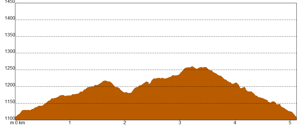
Ascent / descent: 249 m / -249m.
Max / average / minimum altitude: 1262m / 1203m/1105m.
Maximum gradient: 18,9%.
Average gradient: 6,7%.
Terrain: Forest tracks and paths.
Recommended time of year: Spring and autumn
Observations: Take adequate water supplies in summer, watch out for ice in winter.
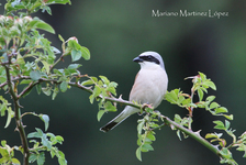
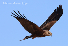
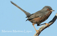
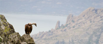
Resident species: Golden Eagle, goshawk, red kite,griffin vulture, black vulture, shrike, cirl bunting, Bonelli’s warbler, stone chat, woodpecker, lesser spotted woodpecker, crested tit,great tit, coal tit, long tailed tit, nuthatch, common chaffinch, firecrest, jay, azure winged magpie, common chaffinch, winter wren.
Species found in summer: booted eagle, European bee eater, black kite, short-toed eagle, golden oriole, bee eater, red-backed shrike, woodchat shrike, subalpine warbler, common whitethroat, common warbler, common nightingale, Bonelli’s warbler, common cuckoo, pied flycatcher, European turtledove, red-rumped swallow.
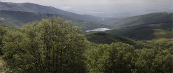
Start near the San Blas shrine, take the trackwhich crosses the San Blas stream and go west. After some metres when you come to the last of the houses, take a left turn. Go along the narrow track,cross the stream and come out into an open area of fields dotted with broom, brambles, hawthorns, and the occasional tree. The trees are mainly small junipers, ash trees in the more humid areas, and the occasional oak tree. On the right,there is a pine forest, a result of reforestation carried out in the 20th century. There are several different ecosystems in this area with a great diversity of species, so take the time to stop and look around.
Continue along the pathfor approximately 1km and go right when you reach the barrier which leads to the San Blas footpath. In this area, there are many species of birds typically found in pine forests, although you will need to listen carefully to detect them as they are harder to see in the tree tops. Wherever there is a stream running through the forest, there are likely to be a wider variety and greater number of birds in the undergrowth.
After walking for almost 2km, continue straight ahead at the fork until you reach a barrier which marks the end of the forest. Continue along the path which runs between stone walls, bushes and old vegetable gardens. A bit further ahead, go left down the concrete roadto where the route joins the RO.02 and then go down the path on the right to the track.Walk south down the track through the forest passing cattle farms, vegetable gardens and clumps of oak and ash trees. After going down a steep hill, take the path on the right which leads back to the starting point.